


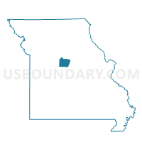
Kelly Voting District, Cooper County, Missouri
About
Outline

Summary
| Unique Area Identifier | 607655 |
| Name | Kelly Voting District |
| County | Cooper County |
| State | Missouri |
| Area (square miles) | 86.44 |
| Land Area (square miles) | 86.33 |
| Water Area (square miles) | 0.11 |
| % of Land Area | 99.88 |
| % of Water Area | 0.12 |
| Latitude of the Internal Point | 38.76663940 |
| Longtitude of the Internal Point | -92.79364420 |
Maps


Graphs
Select a template below for downloading or customizing gragh for Kelly Voting District, Cooper County, Missouri


Neighbors
Neighoring Voting District (by Name) Neighboring Voting District on the Map
- Boonville Rural No. 4 Voting District, Cooper County, MO
- Clarks Fork Voting District, Cooper County, MO
- Otterville Voting District, Cooper County, MO
- Pilot Grove Voting District, Cooper County, MO
- Prairie Home Voting District, Cooper County, MO
- Syracuse North Voting District, Morgan County, MO
- Tipton Voting District, Moniteau County, MO
Top 10 Neighboring County Subdivision (by Population) Neighboring County Subdivision on the Map
- Willow Fork township, Moniteau County, MO (3,856)
- Pilot Grove township, Cooper County, MO (1,222)
- Mill Creek township, Morgan County, MO (1,107)
- Kelly township, Cooper County, MO (716)
- Clark Fork township, Cooper County, MO (655)
- Palestine township, Cooper County, MO (396)
- Lebanon township, Cooper County, MO (329)
- North Moniteau township, Cooper County, MO (255)
- South Moniteau township, Cooper County, MO (211)
Top 10 Neighboring Place (by Population) Neighboring Place on the Map
Top 10 Neighboring Elementary School District (by Population) Neighboring Elementary School District on the Map
Top 10 Neighboring Unified School District (by Population) Neighboring Unified School District on the Map
- Boonville School District, MO (11,591)
- Moniteau County R-VI School District, MO (5,028)
- Pilot Grove C-4 School District, MO (1,708)
- Otterville R-VI School District, MO (1,540)
- Cooper County C-4 School District, MO (933)
Top 10 Neighboring State Legislative District Lower Chamber (by Population) Neighboring State Legislative District Lower Chamber on the Map
Top 10 Neighboring State Legislative District Upper Chamber (by Population) Neighboring State Legislative District Upper Chamber on the Map
Top 10 Neighboring 111th Congressional District (by Population) Neighboring 111th Congressional District on the Map
Top 10 Neighboring Census Tract (by Population) Neighboring Census Tract on the Map
- Census Tract 4701, Morgan County, MO (6,046)
- Census Tract 9505, Cooper County, MO (4,895)
- Census Tract 3854, Moniteau County, MO (3,877)
- Census Tract 9501, Cooper County, MO (3,303)
Top 10 Neighboring 5-Digit ZIP Code Tabulation Area (by Population) Neighboring 5-Digit ZIP Code Tabulation Area on the Map
- 65233, MO (11,703)
- 65081, MO (3,928)
- 65276, MO (1,609)
- 65348, MO (1,350)
- 65237, MO (907)
- 65025, MO (786)
- 65354, MO (628)